Hey, a happy woodpecker story!
NASA has a very interesting if slightly troubled history with woodpeckers. The pecking damage to Space Shuttle Discovery springs to mind, although a delightful upside was public participation and innovations. In the past few years, NASA also joined the hunt for the elusive Ivory Billed Woodpecker, thought to be extinct until spotted in 2004. To date, however, there have been no splashy announcements that more have been spotted... despite the attempt at high-tech ornithology.
And now, a new pecker chapter?
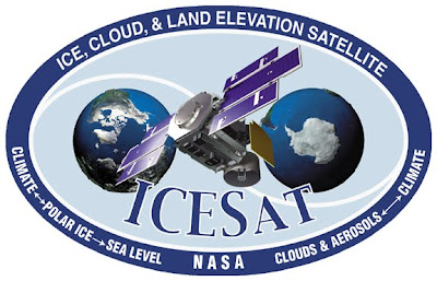
The NASA ICESat, or Ice Cloud and land Elevation Satellite, once the keystone of the Earth Observing System missions for measuring polar ice sheets, clouds and topography, has been re-employed to "monitor" woodpeckers in Idaho. Remember that I do not work for The Onion. Even they couldn't make this up.
Since the satellite was partially designed to provide vegetation data from around the globe, its programming and instrumentation are uniquely suited to its final task of using birds to determine key characteristics of forest biomes. Conventional surveying on foot can be laborious, limited to small areas, and cost-prohibitive -- but satellite-borne lasers can bounce off tree canopies and ground patches, making important woodland attributes easily measurable. (For example, forest density is determined by the relative amount of light returned to the instruments.)
Woodpeckers in particular are good indicators of overall diversity of an ecosystem, because they are incredibly "choosy" about where they live and mate; through their pecking behavior, they also create homes for many other species once they abandon pecked holes from season to season. Once ideal habitats favored by the birds are determined, University of Idaho teams dispatch smaller surveys (think: backpacking all around Moscow Mountain!) to verify the predicted populations.

Attention North American Pileated Woodpeckers:
Satellites are WATCHING you.
Satellites are WATCHING you.
Based on vegetation characteristics and indicators of bird population, biologists can deduce the accompanying mammals and reptiles of a given area – very useful in biodiversity conservation and state land management planning.
I regret now that I never featured ICESat earlier, in the many years of its operation. It has truly provided unprecedented three-dimensional detail of the Earth's surface and climate; it's no exaggeration to say that we know what we do about ice flow patterns and the Arctic / Antarctic water cycles because of this fancy floating gizmo.
ICESat was actually just decommissioned, undergoing many orbit-lowering navigational burns. Having fulfilled its original 7-year mission, it was allowed to degrade into a natural orbital decay and then burn up in the atmosphere. ICESat II is currently being designed, and is expected to launch in 2015 for related missions, including study of biomass, carbon measurements, and changes in polar ice fields.